“The old school of thought would have you believe that you'd be a fool to take on nature without arming yourself with every conceivable measure of safety and comfort under the sun. But that isn't what being in nature is all about. Rather, it's about feeling free, unbounded, shedding the distractions and barriers of our civilization—not bringing them with us.”
-Ryel Kestenbaum
-Ryel Kestenbaum
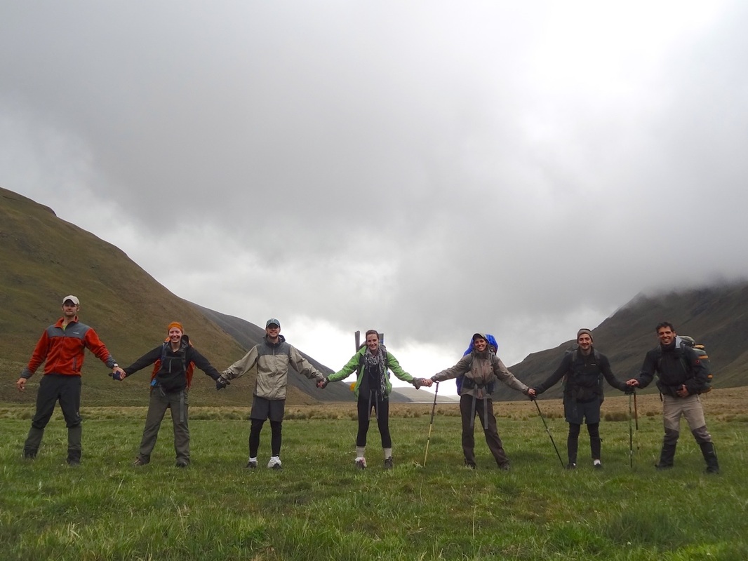
Most of our friends, and most of the country for that matter, decided to head to the beach for Carnival. Somehow the promise of crowds, cocktails, and 24/7 bass beats didn't inspire Lynsey or I, and luckily our friends John and Janet proposed an intriguing alternative: hiking Ecuador's Inca Trail for three days to Ingapirca (Ecuador's most famous Inca ruins site). Vamòs, it was decided - we would spend Carnival with good friends and open space through yet another spectacular portion of this little gem of a country.
We caught an afternoon bus on Friday in Cuenca heading towards La Moya, a town along the Panamerican that our guidebook (Ecuador Hiking & Climbing Guide) describes as the launching point for the adventure. From the get-go the weather promised to be ominous; rich fog enveloped the scenery during most of the bus ride, and we all knew that our three days would be no sunny stroll in the park. Upon arriving in La Moya we ate a filling “mirienda” and were lucky to find a “camioneta” who would drive us up the winding mountain road to Achupallas that night. Four friends piled in the back of the pick-up and Lynsey and I squeezed each other's hand as we watched our driver dodge boulders and earth that had land-slid into the road, all through heavy fog with maybe 20 ft. visibility. We got dropped off at the only hotel our driver knew of in town, the Posada del Ingañan, and agreed to pay the owner $10 for the 7 of us to camp in her backyard. After a wet night we woke up to happily find that the owner had boiling water ready for us and a table to sit at. We enjoyed both of these luxuries that we wouldn't have for the next few days.
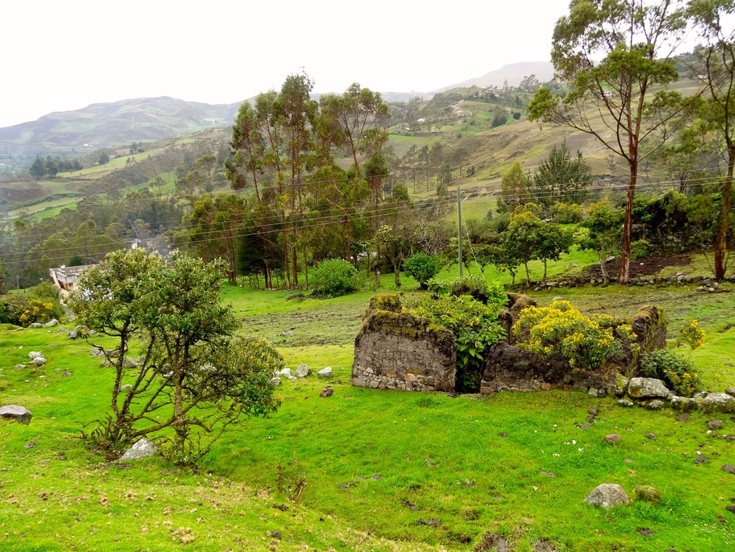
It's amazing how a healthy environment and rainfall can transform an abandoned building
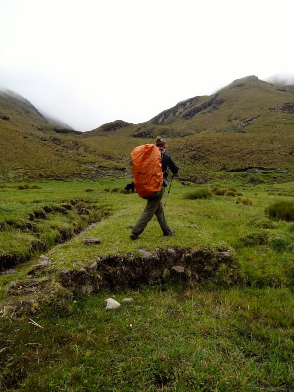
After packing up, we headed out through the town on the directions of a local tienda owner. Hiking on a solid dirt road, we wound our way out of town passing the cemetery en route. We crossed a bridge and followed the guide book's directions to stay on the road as it switchbacked up through beautiful fertile farmland. As John noted, people who imagine the country as a quiet place haven't heard the noise of a donkey's squeal across a valley floor. We shared smiles and hellos with the gentle and friendly campesinos (country folk) and their talkative livestock until one nice lady pointed us onto a smaller footpath that worked it's way up the west side of the valley (I should note, for those that may be planning this trek, that there is also an option to stay along the river at the bottom of the valley, but we, as our group motto, decided to always “take the high road” whenever possible).
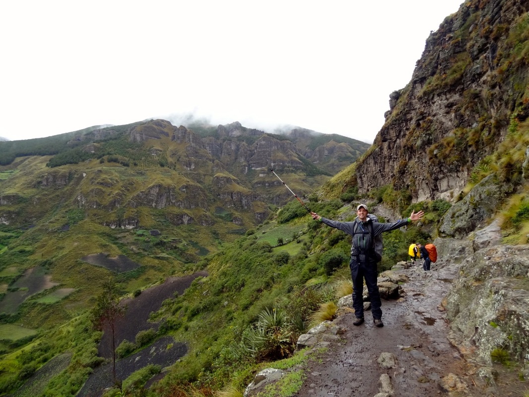
The "high road"
After a couple of hours winding up and through the farmlands on the outskirts of Achupallas, the high trail flattened out and presented us with our first spectacular views of the rocky green valley. Cruising along now, we watched as fog ebbed and flowed in and out of both valley ends, changing the views as we skipped hopped over the saturated ground. We ate a rainy lunch streamside and then gladly moved on to resume circulation and warmth, moving closer and closer to our intended campsite for the night, Laguna Tres Cruces.
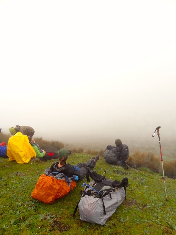
The rest spot where we contemplated where exactly the lake might be
Martin (a new Cuencano friend) and I had a huddle at about 4 or 5 pm to decide we must be close to the lake DESPITE the fact that our visibility had been reduced to maybe 50 yards by the fog. In almost dreamlike fashion we continued on, our eyes squinting and scanning to the west for the lake, when a campesino on horseback came galloping like a mirage towards us. With quiet confidence he assured us the lake was close, that we just needed to go a little further. I checked my compass and we walked blindly into the fog until I noticed a small watery divot in the grass before me only to shout, “LAKE!” We had found it, our worries dissolved, and we set up camp for the night glad to know where we were on the map. To put the icing on the cake, Lauren had prepared an Asian-inspired peanut sauce with vegetables to go on a rice/quinoa mix that took away any prospect that we may be roughing it. Life was good.
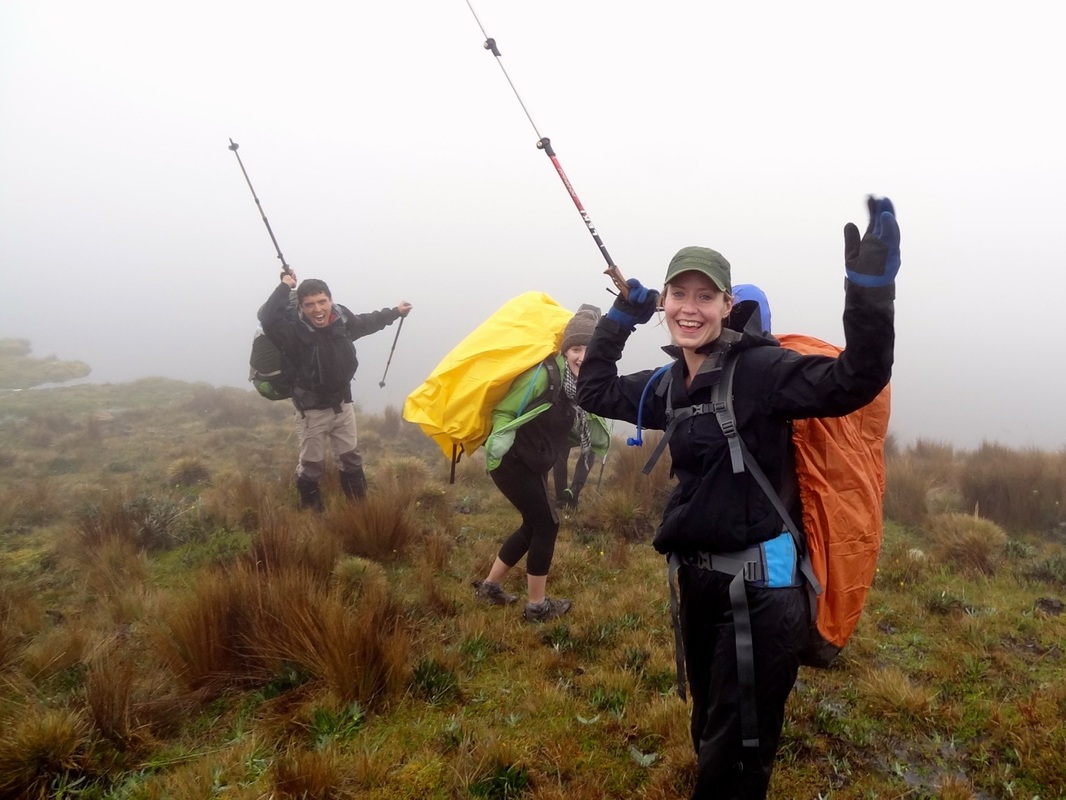
JOY! WE FOUND IT!
We woke up to a much clearer morning looking forward to the middle leg of our journey. After a slow and wonderful morning of hot coffee, oatmeal with apples, raisins, and cinnamon, granola (courtesy of Sam who brought an absolutely gigantic tub of it), and other treats, we finally hit the trail and headed up to an imposing pile of stones marking a pass (and supposedly created by the Inca). From there we, again, chose the high road that would take us up and over Cuchilla Tres Cruces (cuchilla means knife, which is used here to describe the word “ridge”) and then Quillo Loma. Despite being enveloped in fog, we knew that incredible views must surround us in every direction, and when the fog broke we weren't disappointed. The photos sum up our awe at the valleys below us.
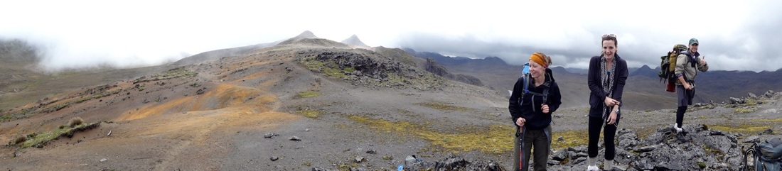
KILLER ridge walk
After a spectacular ridge walk we switchbacked down the side of Quillo Loma until we found a perfect rest spot with a BOULDER ROUTE! Needless to say, a few of us were pumped!
Continuing further down it was incredible to see the way that the old Inca road still imposed it's perfectly straight route into the valley grass. Once on the floor, we found the road, followed it, and came across a section of exposed rock that explained its construction. Here, Lynsey busted a couple of moves.
After an exciting river jump (full on leap from a raised bank to the other side) we settled into a steady pace along the east side of the valley that took us closer to our next campsite, the ruins at Paredones. From a distance we saw the Cañari/Inca road house and marveled at the fact that we would spend the night there - same as so many that had travelled the road for centuries and centuries. I say Cañari/Inca because it's important to note that the Cañari were settled in the area for a substantially longer time than the Inca (in fact, the Inca were only in power in Ecuador for 80 years or so). That being said, most people associate all ruins with the Inca when in fact much of the original construction can be accredited instead to the Cañari. So, now you know - give the Cañari their props!
The ruins gave the campsite a feel of stepping into the past, and we were further impressed to find that builders hadn't only constructed the road house, but also a canal a couple hundred feet above on the mountain side. We clamored up the mountain to pump our water and marveled at the fact that the canal still ran straight as an arrow across the mountainside. Very cool stuff.
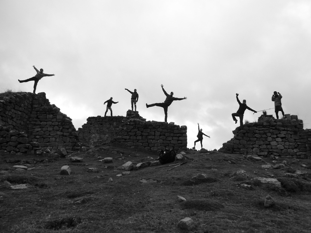
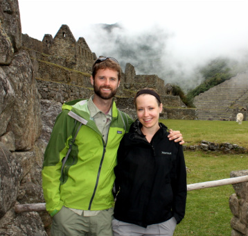
After a dry chilly night we awoke to find SUN on the other side of the valley, a first for the trip! In good spirits we took some trippy pictures in the ruins and started off for Ingapirca, our final destination for the trip. The day took us through lush and beautiful farmland, still following the ancient road, and past small farming villages en route to the famous ruins. In the spirit of Carnival we were ambushed by a little guy with spray foam and a lady on a balcony who flung water down on us. We smiled, laughed, talked, and walked almost effortlessly down the dirt road, letting the trail bring us closer and closer together. When we arrived at Ingapirca the hike was complete; everyone had forgotten the cold wet times and embraced the high of a beautiful trek through history and nature combined. We ate, laughed more, and made our way through the ruins with a sense of connection that wouldn't have been born from a bus trip.
Strong, tired, and glad we made our way back to the city and everyday life. Another spectacular piece of Ecuador uncovered; one that only makes us hungrier to hit the trail and find out what else is out there, waiting patiently for us to arrive.
 RSS Feed
